
About
A Frankenstein Atlas explores Mary Shelley's novel Frankenstein from a spatial perspective. Inspired by research and theoretical approaches in literary mapping and historical geography, A Frankenstein Atlas provides scholars and students with a platform to study and experiment with Shelley's text.
This website provides users with access to the maps, gazetteer, pedagogical approach, and writing generated by the Frankenstein Atlas team. It also provides a link to the datasets and schemas underlying the atlas. Teachers are encouraged to create new maps as well as use, improve, and expand these data sets in their courses by creating Github branches. New work can then be integrated into the main repository and, through collaboration, this project can continue to expand.
Contributors
A Frankenstein Atlas was originally created as a class project for the course, "Machines and the Age of Invention," taught by Jason M. Kelly during Spring 2018. Using Frankenstein as its key text, the course explored the history of science and medical ethics during the 18th and 19th centuries. Topics discussed in class included grave robbing, dissection, gender, and human consciousness. Students in the course worked collaboratively to develop the schema for our analysis as well as coding the text for integration and analysis using GIS. Students who participated in this project included Jessie Cortesi, Dalton Gackle, Patrick Hanlon, Kyla Lewis, Blake Miller, and Sam Opsahl. The schema, data sets, and website is edited by Jason M. Kelly.
This project and the course “Machines in the Age of Invention” were developed as part of IUPUI’s commitment to One State / One Story: Frankenstein, an Indiana Humanities program made possible in part by a major grant from the National Endowment for the Humanities. Any views, findings, conclusions or recommendations expressed in this program do not necessarily represent those of the National Endowment for the Humanities.
The Indiana University Alumni Magazine covered the story in its Fall 2019 issue. See the coverage here.
COming Soon
We will release a series of gazetteer locations that each take a "deep map" approach and link to contemporary drawings and paintings, literary texts, and geophysical descriptions. Also, stay tuned for more details about the pedagogical framework of A Frankenstein Atlas which will be available in the forthcoming article, "A Frankenstein Atlas: A Spatial Humanities Framework for Teaching Frankenstein."
Note that work on this project was put on temporary hold in March 2020 as we shifted our attention to the COVID-19 Oral History Project, but we will be returning to A Frankenstein Atlas in 2023.
Using the Atlas
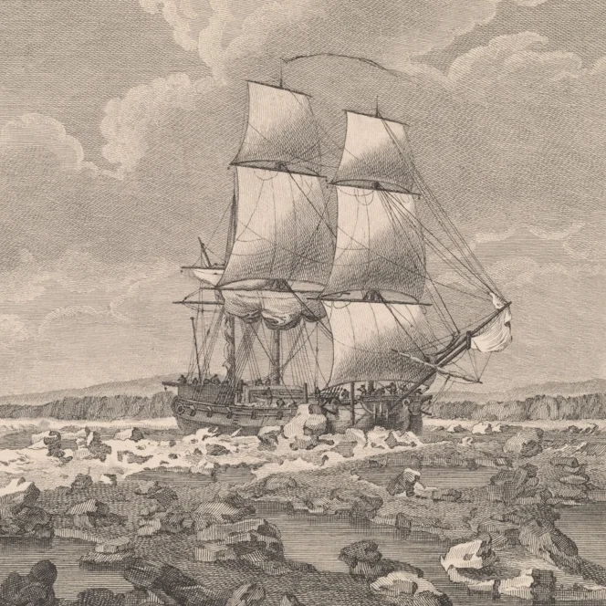
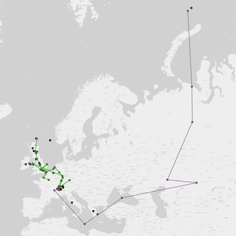
Mary Shelley’s (née Godwin) Frankenstein is a profoundly geographical text. The novel opens with an epistolary exchange between St. Petersburg and London and, from there, it takes readers on a peregrination back-and-forth across Northern Europe and the circumpolar north. The book’s characters expand the text’s geographic boundaries by imagining lands and peoples in the Americas, Asia, and the Pacific. The ways in which Shelley describes these places is essential not only to the narrative but also to our understanding of the novel’s fundamental themes. Given this rich geographical framework, Frankenstein offers teachers a valuable tool with which to explore the historical, geographical, and literary worlds of the late eighteenth and early nineteenth centuries.
An open access project created at IUPUI in 2017-2018 in response to the 200th anniversary of the book’s publication, A Frankenstein Atlas is deeply influenced by the theories and practices associated with the spatial humanities—especially literary mapping, deep mapping, and humanities GIS. This project brings together students and researchers to build a collaborative literary and historical open access atlas of Mary Shelley’s Frankenstein. As a pedagogical experiment, “A Frankenstein Atlas” helps teachers and students explore the rich spatial imaginary of Frankenstein while teaching students basic skills in digital humanities and literary and historical analysis. It highlights how the digital humanities can be employed effectively to teach students about the theoretical and methodological challenges inherent to text analysis and research, using both traditional and digital methodologies. The design of the project and its analytical approach provide a model for how other similar projects might be implemented in the classroom.

Rationale and Methods

Maps and Gazetteer

Data Sets on Github

Bibliography
Map Essays

PEDAGOGICAL FRAMEWORK
The initial coursework for A Frankenstein Atlas focused on creating four outputs: 1) a schema through which to analyze Mary Shelley's 1818 edition of Frankenstein; 2) a gazetteer that linked eighteenth-century place names, modern place names, and geographical coordinates; 3) a data set that traced character movement through time and space and which linked this to their actions and emotions as well as Mary Shelley's use of aesthetics theory in her description of place; 4) a series visualizations and textual and visual annotations using Google maps that introduced students to the functionalities of .kml. Consequently, the coursework associated with A Frankenstein Atlas was part GIS exercise, part visual essay, and part document analysis that examined the historical, intertextual, and imaginative spaces of Shelley’s novel.
The learning outcomes for the project are summarized below:
By the end of this project, students will develop new and enriched knowledge, competencies, and skills as outlined below.
KNOWLEDGE
this project will help students develop an understanding of Frankenstein as both a literary and a historical text
this project will help students to identify and explain how Mary Shelley’s historical, geographical, scientific, and literary references in Frankenstein, fit into broader historical narratives
this project will help students develop an awareness of how digital humanities tools provoke new modes of historical inquiry and analysis
this project will help students better understand the historical geography of eighteenth- and early nineteenth-century Europe
COMPETENCIES
this project will help students develop new interpretive techniques for analyzing historical texts
this project will help students expand the range of questions that they ask as well as interpretive schemas that they develop when engaging with historical texts
this project will help students understand how to interpret literary texts as historically informative documents
this project will help students expand their capacity to develop and work with abstract analytical frameworks
this project will help students cultivate a critical attitude to both the strengths and limits of digital humanities methods
Skills
this project will help students learn new techniques to communicate historical knowledge using HGIS and basic website development
this project will help students learn basic digital humanities proficiencies including how to develop abstract schemas for analyzing and interpreting historical data
this project will help students become more proficient in deep reading and comparative textual and visual analysis
More details about the pedagogical framework of A Frankenstein Atlas will be available in the forthcoming article, "A Frankenstein Atlas: A Spatial Humanities Framework for Teaching Frankenstein."